Flows
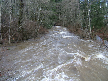
One objective of the Tsolum River Restoration Society is to reduce winter floods and maximize summer flows. The river currently suffers from too much water in the winter and too little water in the summer. The Tsolum River Restoration Society is working to decrease these dramatic extremes with restoration projects and by providing information to the community.
Changes in Flows over Time |
Your browser does not support viewing this document. Click here to download the document.
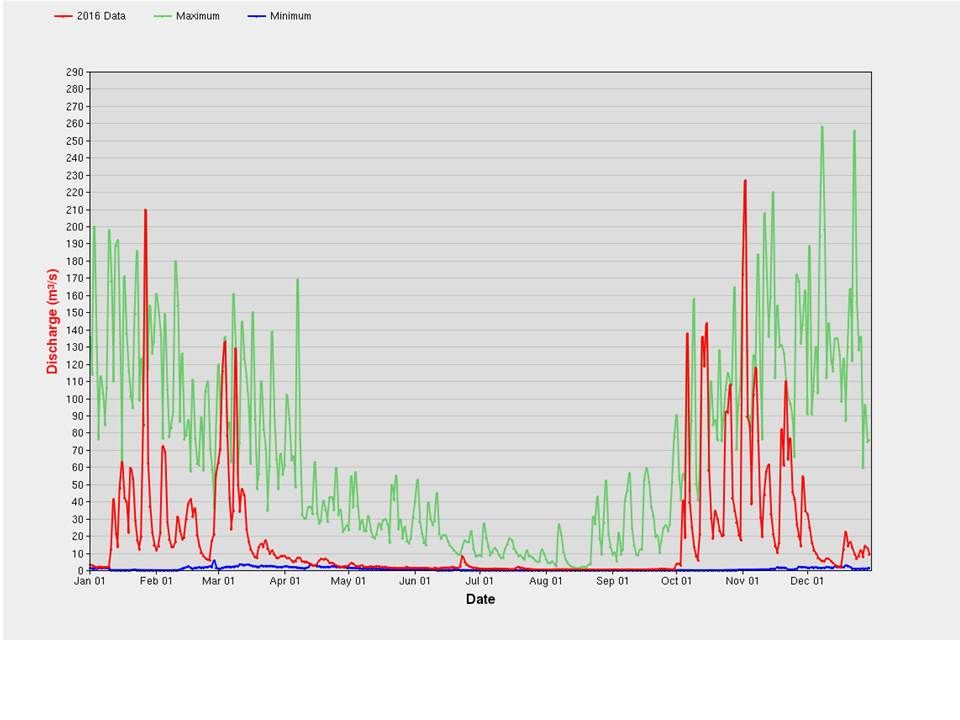
Tsolum River Near Courtenay showing Daily Average Discharge for 2016 compared to max. and min. average flows

The graph above shows peak daily flows in 2016 (in red), maximum flows averaged over 50+ years of monitoring (in green), and minimum flows averaged over 50+ years of monitoring (in blue). Notice that the daily peak flow is often over 50 cubic metres per second (cms) between November and April.
In November, 2011, a high of over 260 cms and in December 2014 a high of over 320 cms were recorded – these events resulted in flooding in the Courtenay River as a very high tide pushed water back upstream. The effects of this push back were felt upstream past the Rees Bridge.
The graph highlights the extreme variation between winter and summer flows. The minimum flows for the 54 years (the blue line running along the very bottom of the graph) is so low it can hardly be seen at this scale. Low flows reduce the available habitat and allow the river temperatures to rise into the toxic zone for fish (ie:> 25 C). The fisheries target is to have a minimum flow of 10% of Mean Annual Discharge or in the case of the Tsolum 1 cms.
How to help regulate flows?
- Create and/or restore wetlands to slow runoff and create fish refuge habitat.
- Restore habitat to create storage and slow runoff (eg: Towhee Creek).
- Stabilize substrates and augment flows (Wolf Lake dam) while fish are in-migrating.
- The Wolf Lake dam is currently used to augment (increase) flows during late summer when Pinks are in-migrating. One option is to increase storage in Wolf Lake (currently used to maintain a minimum flow in the Tsolum River) and possibly create a new discharge point into the Constitution Creek wetland to provide minimum flow to more of the river.
- Developing new storage locations (eg: Lost Lakes, Helldiver Lake, etc. – See 2007 Gooding Report).
- Direct land runoff to storage ponds or seepage galleries to slow runoff and recharge aquifers.
- Create agricultural and rural residential rainwater storage (ponds or cisterns) for irrigation and other farm uses.
- Require any new construction to manage runoff on site (ie: the water balance model).
- Maintain a large minimum lot size to keep development densities low.
- Mount education campaign opportunities to inform all residents about the water cycle, pollutant prevention, safe use of stored water, how to reduce runoff, capture and reuse water.
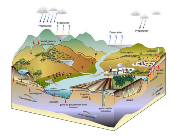
The Water Cycle
Learn more about seasonal streams here.


